País Vasco · Cantabria · Asturias · Galicia
The Camino del Norte, stage by stage
Sea and mountains; hard and spectacular
The Northern Way follows Spain’s north coast from the French border to Galicia: beaches, cliffs, fishing ports and a lot of climbing. The stages, what each region is like, where to split the long days and the best months to walk it.
- km
- 839
- usual days
- 30
- of climbing
- 16,128 m
- highest point
- 712 m
PeregriNeo data based on © OpenStreetMap contributors (ODbL) and Copernicus DEM GLO-30 elevations (© DLR e.V. 2010-2014 and © Airbus Defence and Space GmbH 2014-2018, EU and ESA).
The Camino del Norte (the Northern Way) runs the whole length of Spain’s Cantabrian coast: it leaves Irún, on the French border, crosses the Basque Country, Cantabria and Asturias close to the sea, and enters Galicia at Ribadeo before joining the Francés at Arzúa. It is about 839 km, longer than the Francés, with a lot more climbing: 16,128 metres of total ascent. What it asks of your legs it pays back in scenery.
Elevation profile
The stages
| No. | Stage | Km | Up | Down | Difficulty | Tarmac |
|---|---|---|---|---|---|---|
| 1 | Irun to Donostia / San Sebastián | 25.0 | 670 m | 684 m | hard | 42 % |
| 2 | Donostia / San Sebastián to Zarautz | 22.7 | 493 m | 497 m | hard | 75 % |
| 3 | Zarautz to Deba | 22.4 | 746 m | 748 m | hard | 69 % |
| 4 | Deba to Markina-Xemein | 23.9 | 797 m | 723 m | very hard | 46 % |
| 5 | Markina-Xemein to Gernika-Lumo | 25.3 | 724 m | 791 m | very hard | 44 % |
| 6 | Gernika-Lumo to Bilbao | 32.8 | 898 m | 874 m | very hard | 50 % |
| 7 | Bilbao to Portugalete | 18.8 | 442 m | 437 m | moderate | 88 % |
| 8 | Portugalete to Castro-Urdiales | 34.7 | 549 m | 583 m | very hard | 74 % |
| 9 | Castro-Urdiales to Laredo | 30.9 | 575 m | 582 m | very hard | 80 % |
| 10 | Laredo to Santander | 49.3 | 478 m | 472 m | very hard | 66 % |
| 11 | Santander to Santillana del Mar | 37.5 | 457 m | 376 m | very hard | 89 % |
| 12 | Santillana del Mar to Comillas | 22.2 | 474 m | 539 m | hard | 93 % |
| 13 | Comillas to Colombres | 28.4 | 594 m | 506 m | very hard | 89 % |
| 14 | Colombres to Llanes | 21.6 | 218 m | 318 m | moderate | 81 % |
| 15 | Llanes to Ribadesella / Ribeseya | 30.8 | 327 m | 341 m | very hard | 54 % |
| 16 | Ribadesella / Ribeseya to Sebrayu | 31.4 | 573 m | 562 m | very hard | 76 % |
| 17 | Sebrayu to Gijón / Xixón | 35.9 | 773 m | 777 m | very hard | 76 % |
| 18 | Gijón / Xixón to Avilés | 26.5 | 282 m | 276 m | hard | 69 % |
| 19 | Avilés to Soto de Luiña | 38.5 | 910 m | 909 m | very hard | 66 % |
| 20 | Soto de Luiña to Luarca / Ḷḷuarca | 35.1 | 872 m | 876 m | very hard | 40 % |
| 21 | Luarca / Ḷḷuarca to A Caridá | 30.5 | 501 m | 452 m | very hard | 66 % |
| 22 | A Caridá to Ribadeo | 22.2 | 209 m | 230 m | moderate | 81 % |
| 23 | Ribadeo to Mondoñedo | 35.5 | 1,008 m | 918 m | very hard | 64 % |
| 24 | Mondoñedo to Abadín | 16.7 | 554 m | 183 m | moderate | 80 % |
| 25 | Abadín to Vilalba | 20.6 | 241 m | 269 m | moderate | 43 % |
| 26 | Vilalba to Baamonde | 19.2 | 215 m | 285 m | moderate | 61 % |
| 27 | Baamonde to Sobrado | 40.1 | 617 m | 518 m | very hard | 68 % |
| 28 | Sobrado to Arzúa | 22.2 | 258 m | 382 m | moderate | 81 % |
| 29 | Arzúa to O Pedrouzo | 19.3 | 335 m | 431 m | moderate | 23 % |
| 30 | O Pedrouzo to Santiago de Compostela | 19.3 | 343 m | 365 m | moderate | 65 % |
| Total | 839.3 | 16,128 m | 15,889 m | 67 % |
Distances and elevation measured on the route. Difficulty combines distance and climbing. PeregriNeo data based on © OpenStreetMap contributors (ODbL) and Copernicus DEM GLO-30 elevations (© DLR e.V. 2010-2014 and © Airbus Defence and Space GmbH 2014-2018, EU and ESA).
Ways to walk it
The whole route
From Irún to Santiago de Compostela: 839 km in 30 stages.
Camino Francés
Its final stretch shares the way with the Camino Francés.
Caminos that link up here
- At San Vicente de la Barquera the Camino Lebaniego branches off towards Santo Toribio de Liébana.
- At Bilbao the Camino Olvidado branches off towards Ponferrada.
When to go, difficulty and services
When to go
May to September is the natural season: long days, beaches and open albergues. It rains in any month, so a rain jacket always goes in the pack. In July and August the coast is full of holidaymakers and beds cost more; in winter many albergues close.
Difficulty
- moderate 9 of 30 stages
- hard 5 of 30 stages
- very hard 16 of 30 stages
Longest: Laredo → Santander, 49.3 km.
Most climbing: Ribadeo → Mondoñedo, 1,008 m.
Albergues and services
- albergues
- 389
- places to stay in all
- 1,549
- places to eat
- 7,334
- water fountains
- 1,004
- pharmacies
- 469
Longest stretch with no fountain or bar: 25.1 km. Carry water.
What it is like
A Camino of beaches, cliffs, fishing harbours and green everywhere. At first, in the Basque Country, it climbs and drops all day over the hills; in Cantabria and Asturias it eases off and hugs the coast; in Galicia it turns inland through Mondoñedo and Vilalba. It has more tarmac than the Francés (around 67 %) and fewer albergues, though more open every year.
Since 2015, together with the Primitivo, the Lebaniego and the Basque Interior route, it has been a UNESCO World Heritage Site as the “Routes of Northern Spain”.
Region by region
Basque Country (stages 1 to 8)
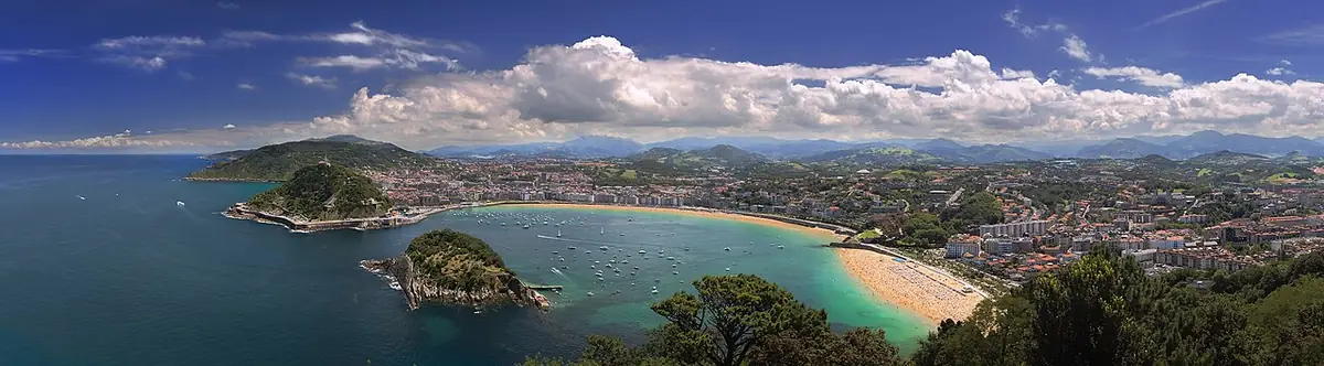
The start over Mount Jaizkibel, La Concha bay in San Sebastián, Zarautz and its beach, Deba, the Gernika oak and the way into Bilbao, with the Guggenheim and the estuary. At Portugalete you cross the estuary on the Bizkaia Bridge, an 1893 transporter bridge that is a World Heritage Site. These are the hardest stages of the Norte because of the constant up and down. Every stage has its own page, starting with Irún to San Sebastián.
Cantabria (stages 9 to 13)
Castro-Urdiales, Laredo and the boat to Santoña, the marshes, Santander, Santillana del Mar (one of the best preserved medieval villages in Spain) and Comillas, with Gaudí’s El Capricho. Several stages cross rivers and estuaries by boat or road bridge: check the timetables.
Asturias (stages 14 to 22)
Llanes and its Cubes of Memory, Ribadesella, Villaviciosa, Gijón, Avilés and the western coast to Ribadeo. Near Villaviciosa the way forks: left to Oviedo and the Camino Primitivo; right to carry on along the coast. Many people decide on the spot.
Galicia (stages 23 to 30)
You cross the Eo estuary to Ribadeo and the Camino leaves the sea to climb to Mondoñedo and its cathedral, then crosses the Terra Chá through Vilalba and Baamonde. The monastery of Sobrado dos Monxes, with its albergue, is one of the most special stops. At Arzúa it joins the Francés and suddenly there are many more people.
The Norte climbs and drops all day, and a stage’s hours look nothing like its kilometres. Allow an extra hour for every 600 metres of climbing, and a little more on rough ground.
What to see
Places along the way, with a couple of lines from Wikipedia.
-
km 25
Santa Maria basilika
La basílica de Santa María advocación a la Virgen del Coro, es una basílica de estilo barroco terminada en 1774 y ubicada en el cruce de las calles 31 de Agosto y Mayor de la "Parte Vieja" de San Sebastián (Guipúzcoa).
Text from Wikipedia (es) · CC BY-SA 4.0
-
km 170
Salazar dorretxea
La casa torre de Salazar, es una casa torre del siglo XIV, construida hacia 1380 en mampostería y se sitúa en la Villa de Portugalete (Vizcaya). Perteneció al linaje de los Salazar.
Text from Wikipedia (es) · CC BY-SA 4.0
-
km 345
Iglesia de San Cristóbal
La iglesia de San Cristóbal es un templo católico situado en el centro de la localidad cántabra de Comillas.
Text from Wikipedia (es) · CC BY-SA 4.0
-
km 520
Capilla de Santa María de los Alas
La capilla funeraria de la familia de las Alas se encuentra en el flanco septentrional de la iglesia de los Padres Franciscanos de Avilés.
Text from Wikipedia (es) · CC BY-SA 4.0
-
km 610
Santuario de la Virgen de Villaoril
El Santuario de la Virgen de Villaoril es un santuario de la Iglesia Católica, que está situado en el pueblo de «Villaoril», perteneciente al concejo de Navia, en el occidente asturiano y allí acuden el día de su…
Text from Wikipedia (es) · CC BY-SA 4.0
-
km 839
Casa do Deán
La Casa do Deán es un pazo, palacio del siglo XVIII situado en el centro histórico de Santiago de Compostela, Galicia, España.
Text from Wikipedia (es) · CC BY-SA 4.0
FAQ
How many days does the Camino del Norte take?
Between 32 and 36 days on foot for most people, more if you stop in cities such as San Sebastián, Bilbao or Santander.
Is it harder than the Camino Francés?
Yes, especially in the Basque Country: more total climbing, more tarmac and fewer albergues. In return, there are fewer people.
Can I walk just one section?
Of course. Many people walk it region by region: the Basque Country one year, Asturias the next. For the Compostela, the usual start in Galicia is Vilalba, about 120 km from Santiago.
Where does the Camino del Norte join the Francés?
At Arzúa, about 39 km from Santiago.
Plan this Camino at your own pace
Pick your start date, how far you want to walk each day and where to rest: PeregriNeo splits the stages for you, tells you when you will arrive and warns you about stretches with no water.