Portugal · Galicia
The Portuguese Coastal Camino, stage by stage
The sea beside you, mild temperatures
From Porto along the Atlantic to Vigo, then inland to join the Central route at Redondela: boardwalks over the dunes, fishing towns and mild summers. Every stage and how to plan it.
- km
- 270
- usual days
- 12
- of climbing
- 3,028 m
- highest point
- 258 m
PeregriNeo data based on © OpenStreetMap contributors (ODbL) and Copernicus DEM GLO-30 elevations (© DLR e.V. 2010-2014 and © Airbus Defence and Space GmbH 2014-2018, EU and ESA).
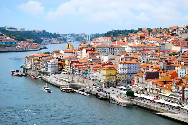
The Portuguese Coastal Camino leaves Porto and runs north along the Atlantic to Vigo, where it turns inland to join the Central route at Redondela. It is about 270 km with the sea almost always in sight, wooden boardwalks over the dunes, fishing villages and some of the most beautiful sunsets on any Camino. In a few years it has gone from a minority choice to one of the most walked routes.
Elevation profile
The stages
| No. | Stage | Km | Up | Down | Difficulty | Tarmac |
|---|---|---|---|---|---|---|
| 1 | Porto to Vila do Conde | 28.6 | 213 m | 260 m | hard | 97 % |
| 2 | Vila do Conde to Esposende | 24.1 | 56 m | 68 m | moderate | 90 % |
| 3 | Esposende to Viana do Castelo | 25.8 | 303 m | 297 m | hard | 84 % |
| 4 | Viana do Castelo to Caminha | 27.6 | 212 m | 216 m | hard | 80 % |
| 5 | Caminha to Oia | 18.1 | 204 m | 199 m | easy | 55 % |
| 6 | Oia to Baiona | 19.2 | 256 m | 257 m | moderate | 71 % |
| 7 | Baiona to Vigo | 26.6 | 437 m | 344 m | hard | 55 % |
| 8 | Vigo to Redondela | 14.9 | 138 m | 227 m | easy | 64 % |
| 9 | Redondela to Pontevedra | 20.4 | 360 m | 349 m | moderate | 57 % |
| 10 | Pontevedra to Caldas de Reis | 21.2 | 195 m | 194 m | moderate | 59 % |
| 11 | Caldas de Reis to Padrón | 18.9 | 231 m | 249 m | moderate | 58 % |
| 12 | Padrón to Santiago de Compostela | 25.2 | 429 m | 180 m | hard | 78 % |
| Total | 270.6 | 3,028 m | 2,837 m | 72 % |
Distances and elevation measured on the route. Difficulty combines distance and climbing. PeregriNeo data based on © OpenStreetMap contributors (ODbL) and Copernicus DEM GLO-30 elevations (© DLR e.V. 2010-2014 and © Airbus Defence and Space GmbH 2014-2018, EU and ESA).
Ways to walk it
The whole route
From Oporto to Santiago de Compostela: 270 km in 12 stages.
Portuguese Camino (Central)
Its final stretch shares the way with the Portuguese Camino (Central).
Leaves the Portuguese Camino (Central) at Oporto
You can walk to the start along the Portuguese Camino (Central) from Lisboa (378 km).
Caminos that link up here
- At Pontevedra the Variante Espiritual branches off towards Pontecesures.
When to go, difficulty and services
When to go
Difficulty
- easy 2 of 12 stages
- moderate 5 of 12 stages
- hard 5 of 12 stages
Longest: Porto → Vila do Conde, 28.6 km.
Most climbing: Baiona → Vigo, 437 m.
Albergues and services
- albergues
- 294
- places to stay in all
- 1,288
- places to eat
- 3,613
- water fountains
- 298
- pharmacies
- 255
Longest stretch with no fountain or bar: 15.2 km. Carry water.
What it is like
Flat in its first half, with long seafront promenades and boardwalks in Portugal, and a little more rolling in Galicia. There is quite a lot of tarmac (around 72 %), though much of it is pavement by the sea. The climate is its great asset: in summer the Atlantic breeze keeps you cool while inland it is 35 degrees. In return, wind and rain arrive without warning.
What you will find
Porto to Caminha
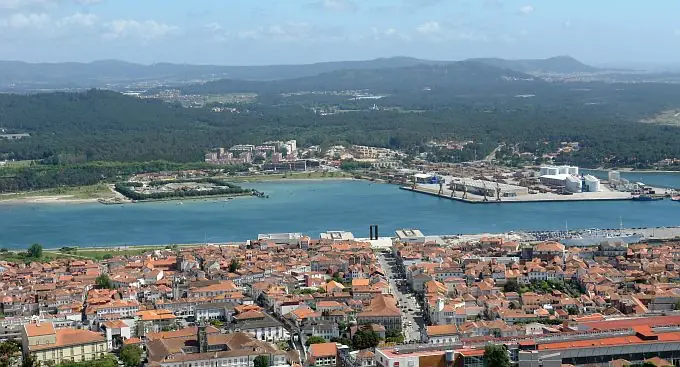
You leave by the mouth of the Douro and Matosinhos and follow boardwalks through the dunes to Vila do Conde, with its aqueduct, and Póvoa de Varzim. Esposende and Viana do Castelo, with the Santa Luzia sanctuary above it, are good stops. At Caminha a small boat crosses the Miño to A Guarda: check the timetable and the tide first, because it does not always run. If there is no boat, you can go upriver to Valença and Tui and carry on by the Central route. Every stage has its own page, starting with Porto to Vila do Conde.
A Guarda to Vigo
The wildest Galician stretch: the coast of Oia, with its monastery facing the sea, and the arrival in Baiona, where the caravel Pinta landed in 1493 with news of the discovery of America. Then comes the Vigo estuary and a long walk into the city.
Vigo to Santiago
From Vigo to Redondela the Camino follows the hillside, with views of the estuary and the Rande bridge. From Redondela it is the same route as the Central: Pontevedra, Caldas de Reis, Padrón and Santiago.
Tips
- Senda Litoral or Coastal Camino. In Portugal there are two parallel routes: the Coastal Camino, a little inland, and the Senda Litoral, right by the sea. They alternate and cross; both are waymarked.
- The Miño boat. Ask the day before. If the river cannot be crossed, the Valença alternative adds a day.
- Sun protection. Little shade on the boardwalks: sun cream, a cap and sunglasses.
- Footwear. Lots of tarmac and wood: cushioned trail shoes rather than stiff boots.
- Time zone. When you cross into Galicia, put your watch forward one hour.
What to see
Places along the way, with a couple of lines from Wikipedia.
-
km 1
Centro Português de Fotografia
El Centro Portugués de Fotografía (cpf) es un museo, archivo y galería de fotografía que se encuentra en la ciudad de Oporto, en Portugal. Fue creado en 1997 por el Ministerio de Cultura de Portugal.
Text from Wikipedia (es) · CC BY-SA 4.0
-
km 81
Citânia de Santa Luzia
La citania o castro de Santa Luzia es un yacimiento arqueológico portugués, situado junto a la ciudad de Viana do Castelo, en la región norte de Portugal, y emplazado sobre el Monte de Santa Luzia, que alberga asimismo…
Text from Wikipedia (es) · CC BY-SA 4.0
-
km 106
Torre do Relógio
La torre del Reloj, antiguamente llamada puerta de Viana, es un edificio de Caminha, en el distrito de Viana do Castelo, Portugal.
Text from Wikipedia (es) · CC BY-SA 4.0
-
km 167
Museo Etnográfico Olimpio Liste
El Museo Etnográfico Liste de Vigo acoge una colección de más de 2 000 piezas de la cultura material y espiritual de Galicia, y que recorre de forma monográfica el patrimonio gallego de los oficios artesanales, muchos de…
Text from Wikipedia (es) · CC BY-SA 4.0
-
km 206
Real Basílica de Santa María a Maior
La iglesia de Santa María la Mayor de Pontevedra, es una iglesia católica, datada en el siglo XVI, que desde 1962 es Basílica, por decreto del Papa Juan XXIII. Combina los estilos gótico tardío y renacentista.
Text from Wikipedia (es) · CC BY-SA 4.0
-
km 270
Casa do Deán
La Casa do Deán es un pazo, palacio del siglo XVIII situado en el centro histórico de Santiago de Compostela, Galicia, España.
Text from Wikipedia (es) · CC BY-SA 4.0
FAQ
How many days does the Portuguese Coastal Camino take?
Between 11 and 13 days on foot from Porto, depending on your pace and whether you take the Spiritual Variant at the end.
Can I start in Vigo or Baiona?
Yes. From Vigo it is about 100 km to Santiago, enough for the Compostela. From Baiona it is about 127 km.
Is the Coastal route easier than the Central?
In climbing, yes: it is flatter. On the other hand, it has more tarmac and some long stages along the Galician coast. If you want mild temperatures in summer, the Coastal wins.
Plan this Camino at your own pace
Pick your start date, how far you want to walk each day and where to rest: PeregriNeo splits the stages for you, tells you when you will arrive and warns you about stretches with no water.